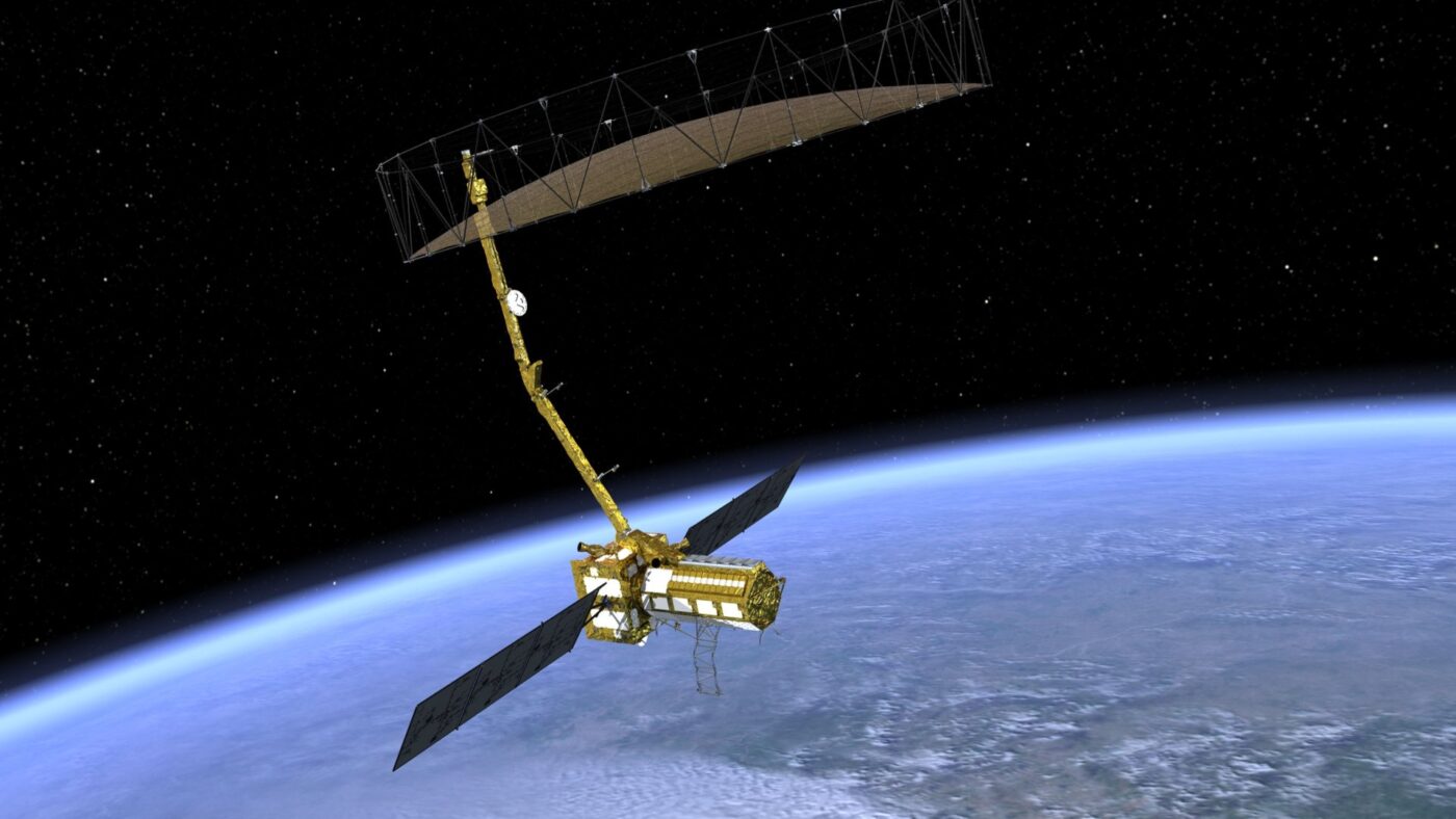
NISAR, a joint Earth-observing mission between NASA and ISRO, aims to measure changes in our planet's surface and study natural hazards and global environmental change.
September 2020

An artist’s concept of NISAR. Photograph courtesy NASA
Imagine a world in which scientists are able to see minute changes in glaciers, sea levels, crops, aquifers, and even volcanoes before they can cause mass upheaval.
This might soon become a reality, thanks to a groundbreaking partnership between the National Aeronautics and Space Administration (NASA) and the Indian Space Research Organisation (ISRO). The space agencies have worked together to design the NASA-ISRO Synthetic Aperture Radar (NISAR), a first-of-its-kind, dual-frequency radar system that will be housed on a satellite, optimized for studying hazards and global environmental change. Synthetic aperture radar refers to a technique of producing fine-resolution images from a resolution-limited radar system. NISAR will measure Earth’s changing ecosystems, dynamic surfaces and ice masses, providing information about biomass, natural hazards, sea level rise and groundwater, and will support a host of other applications. It is scheduled to launch in 2022 from the Satish Dhawan Space Centre in Sriharikota.
“NASA and ISRO have a rich history of cooperation, going back to the earliest days of the space age in the early 1960s, when NASA cooperated with ISRO’s predecessor organization [Indian National Committee for Space Research] to launch sounding rockets in India for scientific study,” says Karen M. St. Germain, director of NASA’s Earth Science Division. “Since that time, NASA and ISRO have cooperated in many different areas, including a mission to the Moon.”
NISAR represents the next step forward in the cooperation between the two space agencies. “Whereas most international science activities that NASA engages in involve a lead partner and a supporting partner, NISAR is an exception,” says St. Germain. “NASA and ISRO are working closely together in an equal partnership, with each agency providing substantial contributions to the mission. The only way to succeed at a project of this scale and complexity—that is as interconnected as this mission is—is for each agency to fully commit to the project and to each other.”
While NASA is providing the mission’s L-band synthetic aperture radar, a high-rate communication subsystem for science data, Global Positioning System (GPS) receivers, a solid-state recorder and payload data subsystem, ISRO is providing the spacecraft bus, the S-band radar, the launch vehicle and associated launch services.
Raju Sagi, ISRO’s NISAR project director, notes that the radar system can capture data from all over the planet in all weather conditions, day or night. This will allow scientists to better understand the effects of climate change and other ecosystem disturbances as well as natural hazards.
Sagi concurs with St. Germain that the partnership has been ideal. “Despite both teams being located halfway across the globe, the teams have been working well together, adjusting to each other’s time zones and interacting amicably over the available communication media, email, phone and the Internet on an almost day-to-day basis,” says Sagi. “There is this comfortable feeling among the teams that the project is working 24 hours daily, literally. When one team goes to sleep, the other team is up and working at the other end of the globe! Apart from this, the face-to-face meetings happening occasionally between the teams at ISRO and JPL [NASA’s Jet Propulsion Laboratory] always had a component of bonhomie and the teams always acknowledge this to each other.”
“I personally am incredibly fulfilled by this relationship,” says Paul A. Rosen, project scientist for the NISAR Mission, based at NASA’s JPL in California. “It is a very ambitious mission. It’s probably the biggest partnership in space that the U.S. and India have ever done.”
The collaboration has been in the works for nearly a decade. JPL had explored partnerships with various countries, but “nothing quite worked,” says Rosen. “Then, because of the Indian relationship, one of the managers at JPL said, ‘Why don’t you go and see if they’re interested?’ So, in December 2011, I flew all by myself for the first time to India and gave a presentation about our mission. And they said, ‘Yes, this is exactly what we’ve been wanting to do.’ ” It took two to three years to work out the details. “What finally sealed the deal was a meeting between President Barack Obama and Prime Minister Narendra Modi,” he adds.
Rosen says understanding the planet’s systems as a whole is critical. “We live on Earth, so we think we know everything about Earth. But we really don’t,” he continues. “NISAR will provide an unprecedented look through radar eyes to create dynamic movies of the Earth in motion. It’s going to be a very exciting, first-of-a-kind mission that will really benefit society.”
Frequent data collection will benefit scientists as well as emergency responders, and interested parties will be able to access NISAR’s data for their own projects. “NISAR itself will produce more data than NASA has ever acquired in its entire history, from all of its other missions,” says Rosen.
Although the coronavirus pandemic has slowed the progress, Rosen is still optimistic about the future. “This COVID-19 situation was really a monkey wrench in the works, unfortunately. We were just to the point of bringing the ISRO major hardware together with our major hardware,” he says. “But, we’ve been waiting for a very long time for this mission, so another year will not make it any less valuable.”
Candice Yacono is a magazine and newspaper writer based in southern California.
COMMENTS